 |
|||||||||||
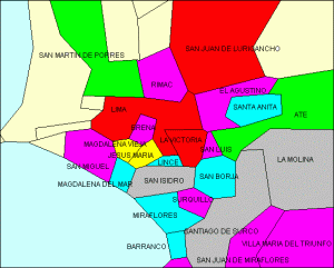
GIS ConsultingMy first practical experiences with GIS software I was getting in Colombia, in the CVC, where the existing numeric information in the databases should be transferred from Informix to Oracle. The applied GIS software was ArcInfo, but the data handling for the digitalization was done with AutoCAD, finishing the capturing activities transferring the results to ArcInfo After finishing the basis geography where published different thematic maps using as first input the historical data of the CVC, elaborating manly water, soil and soil use maps. In special cases where used manual data capturing employing walkers to capture interesting facts in site, also for the basic geography where the satellite capture was not explicit. The
information system "Balance of production, ex- and
import of sensible products", a dual usable system,
developed under my specifications and control have had
also a georeferenced result output, which was giving the
information about the superposition of different results
in the captured area. Exactly this capability was the
advantage of this new information system.
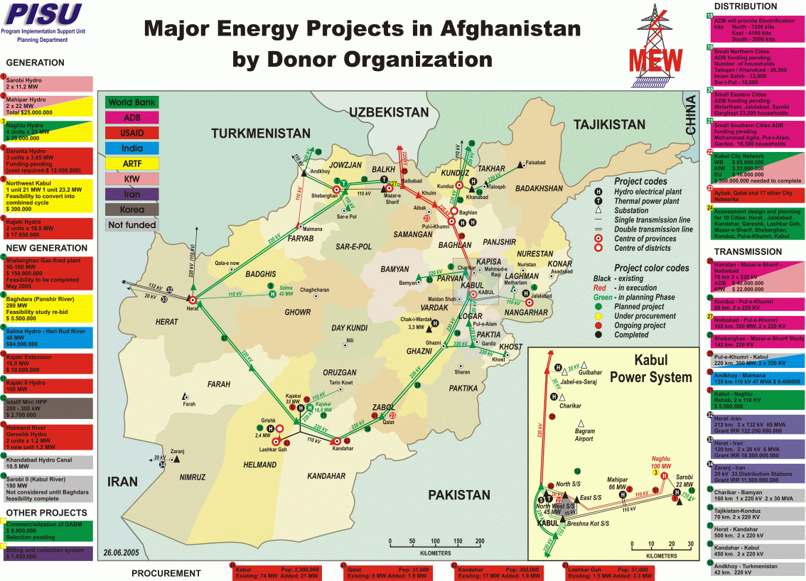
In Germany I was working in the year 2002 as freelancer for the Agrargenossenschaft Malchow with a GIS- system. The program was a proprietary solution from the hardware producer, but the general solution is the same as in the standard GIS software. New for my was the connection between the desktop software and the palm tops, doted with GPS, which are used for the data capturing as well to display a subset of results for the operative work. It was for mi a new experience to se the high technical level in the agriculture, or better I must say agriculture industry. In Kabul, 2004, was one of the first tasks to fulfill our PISU team should support the survey of the Kabul Medium Voltage Network to prepare the planning of the reconstruction of the same. For this task we have bought the basic geography from Kabul from a third party and with the support from a group of afghan engineers was taken the data from all old lines, marking the existing part inside the maps. These hand marked raw data in the prints of the maps was transferred to AutoCad in a special layer of the map. In a similar form was captured the low voltage network of Kabul East. According to our plans the contractor of the
construction should give later the exact GPS coordinates
of each element of the network, correcting so the
existing information and setting the basis for a real
GIS system application. The structure of the database
was prepared and the execution is waiting until the
assignation of the biddings.
Additionally to these tasks I was working in the GIS support of other projects executed by short time consultants, supplying the corresponding basis information or in the preparation of the drawings which were giving the results in geographic form or as technical drawing. In conclusion should mentioned that I have experiences in the following aspects:
For more extensive projects in this area I can count with the support of group of qualified staff from Asia. |
|||||||||||
|
|||||||||||